
Nepal floods: Avalanche from 5,200 metres raced down Himalayas at 167 kmph, triggering deadly deluge

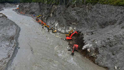
The ice-rock avalanche that triggered Nepal’s devastating August 26 floods moved with extraordinary speed, covering around 22 kilometres to Rasuwagadhi in just over seven minutes, according to a preliminary study by Nepalese scientists.The mass travelled at an estimated average speed of 46.3 metres per second, or about 167 kmph, as it plunged from the high Himalayas into the river system below, news agency PTI reported.The study, commissioned by the Nepal Environment Society (NES), found that the massive mass of ice, rock and debris began falling from the northern part of the Langtang–Lirung area of Rasuwa at around 8.37 am.Starting at an altitude of approximately 5,200 metres, the avalanche descended steep terrain before reaching the Lhende River at about 2,930 metres. It then surged downstream through the Bhotekoshi and into the Trishuli river system, generating a powerful debris-laden flood.The speed of the initial surge helps explain the devastation downstream. Although the flow slowed to around 73 kmph between Rasuwagadhi and Betrabati, it continued carrying enormous quantities of rock, sediment and soil. Farther downstream, its speed fell to around 22 kmph, but the debris-loaded torrent retained enough force to cause widespread destruction.Satellite imagery showed major geographical changes across an area of about 10 square kilometres, while a section of glacier covering approximately 0.56 square kilometres had broken away.The findings also challenge the initial assumption that the disaster was caused by a glacial lake outburst flood (GLOF). Researchers found no evidence of a GLOF after analysing satellite imagery, hydrological and meteorological data, terrain characteristics and changes in elevation and slope along the river system.There was also no evidence of exceptionally heavy rainfall in the upper watershed on the day of the disaster, weakening the theory that an extreme cloudburst or rainfall event alone caused the floods.The study noted another striking feature: water levels and river flow in the Rasuwagadhi and Syafrubesi areas fell several hours before the destructive surge arrived. At Rasuwagadhi, the average water level declined between 5 am and 8 am, while flow at Syafrubesi began falling at around 7 am.Scientists, however, said further field investigation is needed to establish the precise geological mechanism, the contribution of melting ice and whether the river was temporarily blocked upstream.The avalanche also caused extensive damage to Nepal’s hydropower infrastructure. Preliminary Nepal Electricity Authority data cited in the study showed that 13 hydropower projects and one solar project were affected, taking around 431 MW of generation capacity out of the system.The floods killed at least 900 people, according to authorities, with thousands still missing. Rescue teams were continuing to search for hundreds of workers believed to be trapped inside hydropower tunnels in the worst-hit districts of Rasuwa and Nuwakot.The disaster has also left behind the threat of further landslides, unstable glaciers and potentially dangerous lakes, raising concerns that the Himalayan region could face additional flooding even after the initial torrent has passed.


