
2015 Kathmandu earthquake, 2026 flash floods: Why Nepal is so susceptible to natural disasters

Nepal is once again confronting the destructive force of nature, with flash floods sweeping through communities along the Bhote Koshi and other rivers, killing dozens and leaving hundreds missing. The disaster has devastated settlements, roads, bridges and hydropower infrastructure in northern Nepal, while a mudslide in Tibet has also caused deaths and left hundreds missing. Rescue operations have been complicated by swollen rivers, damaged roads and difficult mountain terrain.The scale of the disaster has also exposed Nepal’s vulnerability to hazards that can quickly cross geographical boundaries. Officials have warned people to stay away from the banks of the Bhotekoshi, Trishuli and Narayani rivers, while helicopters have been deployed to rescue people stranded by floodwaters. The same region experienced a deadly flash flood last year, when a glacial lake outburst in neighbouring Tibet killed at least nine people and damaged the bridge linking Nepal and China.The latest disaster has renewed questions about why Nepal is so susceptible to natural calamities. The answer lies in a combination of its location between two tectonic plates, steep and fragile Himalayan terrain, intense monsoon rainfall, rapidly changing glaciers and high exposure of communities and infrastructure to hazardous areas.
A country caught between tectonic plates
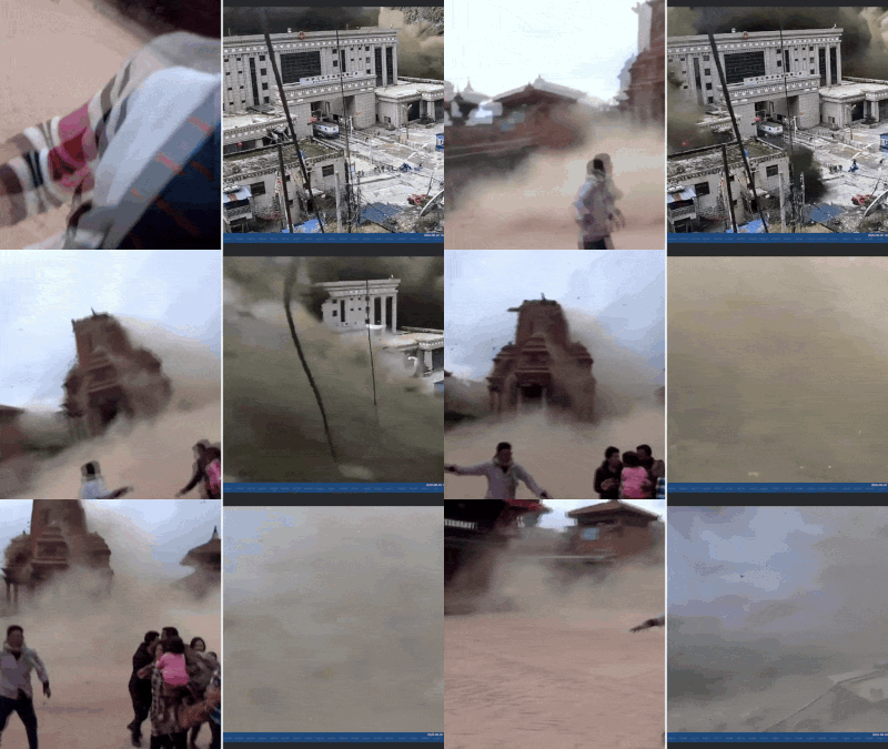
Nepal sits along the boundary where the Indian and Eurasian tectonic plates collide. The Indian plate is being pushed beneath and against the Eurasian plate at roughly 5cm a year, building enormous geological pressure that is periodically released through earthquakes.The devastating Kathmandu Valley earthquake illustrated the consequences of that vulnerability. The region’s mountainous terrain can amplify the impact of earthquakes by triggering landslides, avalanches and road blockages, while dense settlements and vulnerable buildings can turn seismic activity into a humanitarian disaster.The Kathmandu Valley also has a deep layer of clay beneath it. During a strong earthquake, seismic vibrations can cause water-saturated soil to lose its strength and behave like quicksand, a process known as soil liquefaction. This can severely damage buildings, roads and other infrastructure.Earthquakes therefore do not remain isolated events in Nepal. A major tremor can set off a chain of secondary disasters, including landslides, avalanches, blocked rivers and damage to hydropower and transport infrastructure.
Where mountains turn hazards into disasters
Nepal’s geography makes the country particularly exposed to floods and landslides. Steep slopes and narrow valleys mean that water and debris can travel rapidly downhill, leaving little time for communities to respond.The latest Bhote Koshi disaster is an example of this cascading risk. Initial assessments suggested that an earthquake may have triggered an ice-and-rock avalanche or landslide, blocking the river before releasing a sudden surge downstream. Experts have described such events as “cascading hazards”, where an incident high in the mountains rapidly becomes a flood disaster in settlements below.The risks are not confined to the mountains. Nepal’s southern Terai plains are highly exposed to river flooding, inundation and riverbank erosion, while communities in the hills face landslides, debris flows and flash floods. Roads, bridges, schools, hospitals, irrigation systems and hydropower projects are frequently located in areas exposed to these hazards.
A warming Himalaya is adding another layer of risk
Climate change is making an already hazardous environment more unpredictable. Nepal is home to thousands of glaciers, and rising temperatures are accelerating glacier loss and changing snowmelt and river-flow patternsLast year’s deadly flooding in the same region was traced to the drainage of a supraglacial lake in Tibet. The current disaster may have had a different immediate trigger, but the repeated flooding demonstrates how vulnerable the region has become to changes in the high mountains.Climate change is also associated with more erratic rainfall and more intense extreme weather. Heavy monsoon rain can saturate already fragile slopes, triggering landslides and worsening river flooding. In a country where agriculture, hydropower, tourism and rural livelihoods depend heavily on climate-sensitive resources, the consequences can spread well beyond the immediate disaster zone.
2015 earthquake: When the mountains became a threat
The 2015 Gorkha earthquake offered a devastating glimpse of what happens when Nepal’s geological and geographical vulnerabilities collide. A magnitude 7.8 earthquake struck on April 25, followed by another powerful 7.3 tremor weeks later, killing nearly 9,000 people and injuring more than 22,000. Homes, schools, hospitals, roads and historic structures were destroyed, leaving millions affected.But the danger did not end with the shaking. The earthquakes unleashed landslides and avalanches across the country’s steep mountain terrain, blocking roads and cutting off communities. Fragile slopes were left vulnerable to further collapse, particularly as the monsoon approached. The disaster showed why a major earthquake in Nepal can quickly become a chain reaction of hazards — triggering landslides, avalanches, infrastructure failures and isolation in areas that are already difficult to reach.
Why vulnerability is about more than nature
Nepal’s exposure becomes more dangerous when natural hazards overlap with poverty, weak infrastructure and limited access to essential services. More than 80% of the population is exposed to some form of natural-hazard risk, according to the material provided.The most vulnerable include mountain communities, farmers, people living along rivers and unstable slopes, informal urban settlements, children, older people and households with limited financial resources. Damage to roads and bridges can isolate entire communities, while disasters can disrupt healthcare, education, water supplies and food production.Nepal has a National Disaster Risk Reduction and Management Authority responsible for coordinating disaster preparedness, search and rescue, information systems and risk-reduction measures. But reducing losses requires more than emergency response after a disaster strikes.


