
Nasa captures stunning view of Super Typhoon Bavi from space

For people living across Guam and the Northern Mariana Islands, early July brought another reminder of how quickly conditions can change in the western Pacific. Super Typhoon Bavi arrived as an exceptionally powerful storm, crossing near the islands with destructive winds, heavy rain and dangerous coastal flooding. According to Nasa, the cyclone reached its greatest strength as it passed through the region, becoming the third Category 5 tropical cyclone of 2026.Satellite imagery captured during the night offered a striking view of the storm from space. Yet behind those images was a weather system causing real disruption on the ground, damaging infrastructure and adding to recovery challenges left behind by an earlier major typhoon only a few months ago.
Nasa’s VIIRS instrument reveals stunning view of Super Typhoon Bavi
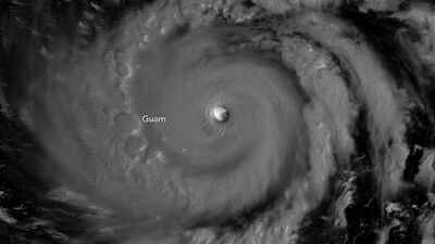
One of the most unusual views of Bavi came from a Nasa-supported satellite observation taken shortly after midnight local time on 6 July. The image showed the storm’s eye surrounded by a tightly organised eyewall, with moonlight illuminating part of the cyclone from above.According to Nasa, the image was collected by the Visible Infrared Imaging Radiometer Suite (VIIRS) aboard the NOAA-20 satellite. At the time, Bavi was near peak intensity. Several hours later, the eye moved across Rota, one of the islands in the Northern Marianas.The satellite view highlighted how compact and well-defined the storm had become as it travelled westward across unusually warm ocean waters.
How El Niño conditions may have fuelled Super Typhoon Bavi’s rapid intensification
Bavi intensified over a region where sea surface temperatures were around 30 degrees Celsius. Warm water acts as fuel for tropical cyclones, providing the energy needed to strengthen thunderstorms around the storm’s centre.According to Nasa, the typhoon reached super typhoon status on 4 July local time while moving west across the Pacific. By the time it approached Guam and the Northern Mariana Islands, sustained winds had climbed to around 290 kilometres per hour.Meteorologists have been watching the 2026 Pacific season closely because of developing El Niño conditions. As noted by weather experts cited by Nasa, storms that form farther east during El Niño years can spend more time over warm water before turning towards Asia, increasing the possibility of reaching the highest intensity categories.
Super Typhoon Bavi leaves damage and flooding across Guam and Northern Mariana Islands
pc:Nasa
While satellite images showed a remarkably organised storm, communities beneath it faced a much harsher reality. As per Nasa, powerful winds knocked down power lines and poles, while flooding and storm debris affected roads across several islands. Buildings also suffered damage, including infrastructure linked to water distribution on Rota.Emergency crews spent days responding to the aftermath. The U.S. Coast Guard worked to remove navigation hazards and help restore access to ports once sea conditions became safer. The recovery effort came only weeks after residents had dealt with Super Typhoon Sinlaku, another destructive storm that struck the same region in April.
Nasa tracks Super Typhoon Bavi as it approaches Taiwan and Southern Japan
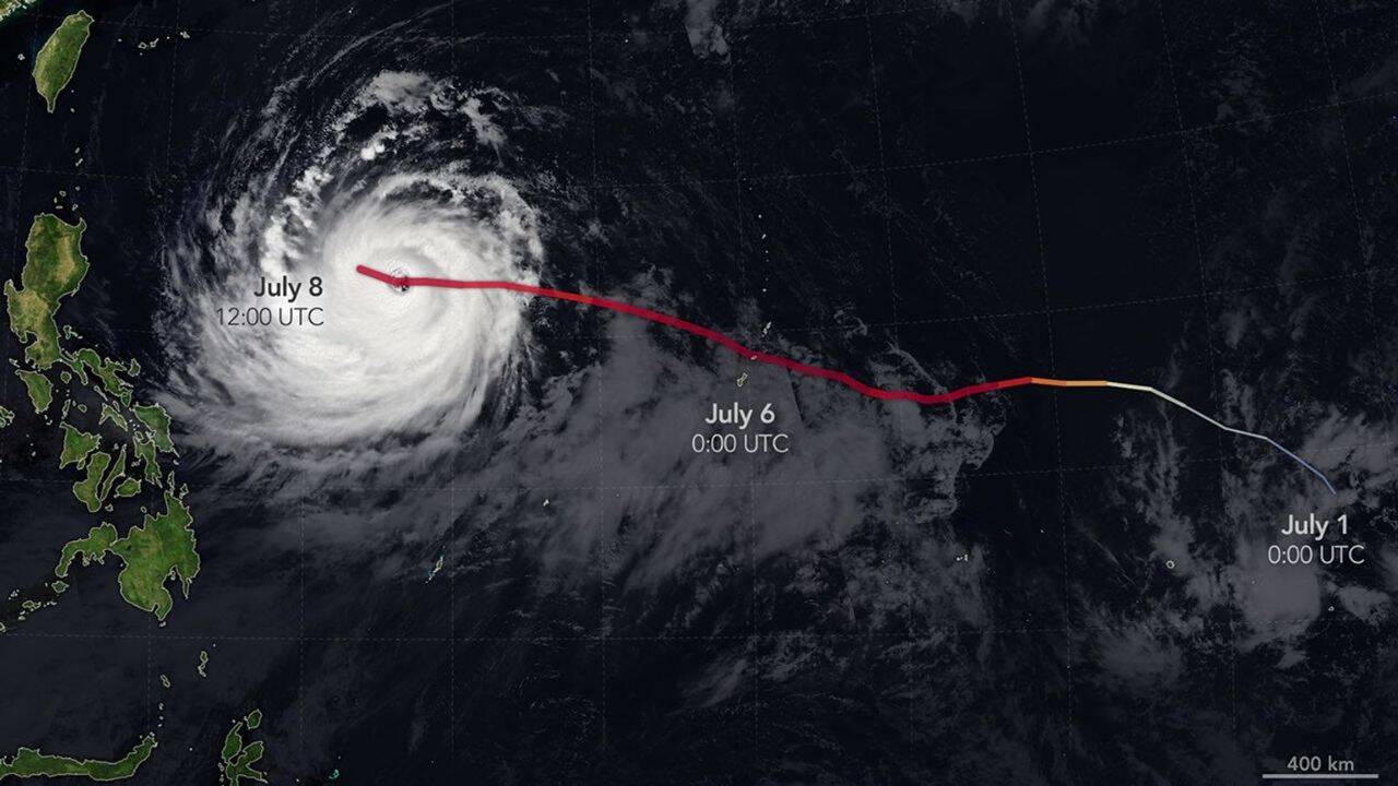
By 8 July, Bavi remained a formidable typhoon despite showing signs of gradual weakening. Satellite imagery released by Nasa showed the storm moving west across the Philippine Sea, southeast of Taiwan.At that stage, maximum sustained winds were still estimated at around 250 kilometres per hour. Forecasts suggested the cyclone could begin curving northwest, potentially affecting Taiwan, the Ryukyu Islands of southern Japan and parts of mainland China.Although weakening was expected over the following days, Bavi remained a powerful system capable of producing damaging weather far from the islands where it first made headlines. As forecasters continued to track its path, the storm stood out as one of the strongest tropical cyclones observed anywhere in the world during 2026.


